A revolutionary tool to monitor floods
Published on 22/11/2021
LIST has developed one of the key components of a new tool which is expected to contribute to disaster risk reduction worldwide.
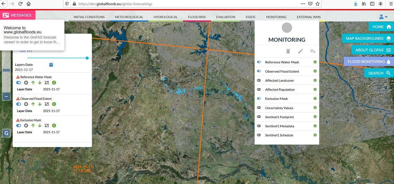
On 27 October, the Joint Research Centre (JRC) launched the Global Flood Monitoring (GFM) tool to monitor ongoing floods around the world as part of the Copernicus emergency management service. The GFM tool allows users to better prepare for an upcoming flood and to better react to an ongoing flood. This systematic, global, high-resolution monitoring represents a significant advance in EU disaster awareness and prevention.
This tool, unique in its ability to process all the data received by the Copernicus Sentinel-1 satellites, can help plan and coordinate emergency responses to floods or support international aid to affected areas. For example, it has already been tested this summer to develop maps of the floods that hit Europe in July 2021.
LIST researchers Patrick Matgen, Ramona Pelich, Marco Chini, Renaud Hostache, and Yu Li developed one of the three algorithms for extracting satellite data, the other two having been developed by the Technical University of Vienna and the German Aerospace Centre. “We have been working on flood monitoring technologies for 15 years. We are grateful to the National Research Fund and the European Space Agency for having funded this research for so many years. In the last couple of years, the eshape project, which was funded by the European Commission via its H2020 program, helped us to upscale our algorithm. We are proud that our algorithm is now a central component of the operational GFM service,” explains Patrick Matgen, Group Leader at LIST. “We had already generated many flood maps using satellite data with our HASARD® tool. The big novelty with GFM is the systematic approach and the scale, which is global. The data is now produced automatically.”
GFM produces flood monitoring maps in less than 8 hours after the satellite has acquired the image, with a spatial resolution of 20m globally. For Europe, the tool can provide flood monitoring maps updated every 1-3 days, while for areas outside Europe, the update of flood maps can take between 6-12 days depending on the Sentinel-1 schedule.
The tool, currently in its pre-operational phase, is available free of charge to the civil protection services of the EU Member States and its partners. It is also relevant for insurance companies, as it can provide them with risk maps through the integration of land cover maps and census data. It can therefore be used to assess the number of people affected by a flood and highlight the infrastructure that is impacted by the event. “In Europe we have a lot of data measured in situ, but in many parts of the world no information is available,” says Patrick. In a way, the tool makes the data, and therefore the help, accessible.
Sentinel-1's synthetic aperture radar allows images to be acquired regardless of weather conditions or daylight. However, the team still needs to improve the algorithm and is working on a few technical issues, such as water look-alikes: for example, it may happen that large desert areas are falsely recognised as water by the algorithms - an effect similar to mirages, the natural optical illusions in which light rays are bent by refraction to produce a reflection of the sky on the ground.
GFM is the result of years of scientific development by LIST and its partners. Yet the project was implemented in a record-breaking one year.
Patrick and his team do not intend to stop there: after creating the Wasdi spin-off at the end of 2020 and participating in the development of GFM, they now intend to continue improving the accuracy of the maps and the robustness of the service. Moreover, they plan to take advantage of the global dataset and, for example, analyse the impact of climate change on flood risk worldwide.
Share this page: