New services based on satellite data
At LIST, we are developing technologies and services based on satellite data for a whole series of applications.
We are currently working on:
- Precision agriculture: we are providing tools and data to optimise agricultural management, particularly crops, based on earth observation data combined with data obtained from drones and in situ data.
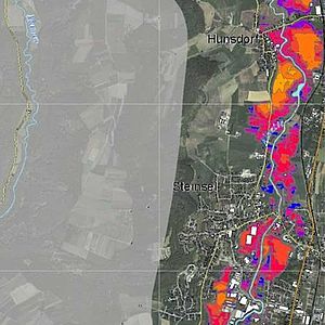
- Resource management and natural risks: through the integration of air-based and field-based satellite imaging data, we offer solutions in the field of resource management and natural risks, in particular flood management.
Example of achievements:

Flood management via satellites
We have developed a real crisis centre for flood prevention and management via satellites + Learn more
Benefits of our solutions:
- Interpretation of satellite data in order to extract different types of information
- Manipulation of dynamic big data from different sources (satellites, on-the-ground reports)
- Cross-checking of satellite data and ground data (agile cross-checking)
- Prediction models
- Simulation scenarios
- Improved quality of interactions between people
- Decision support
- Support for governance


